Introduction:
Where? :
Located at the north side of Point Reyes cape, at the end of Pierce Point road.
Google Map Link
My highway 1 north section trip planner link:


What? :
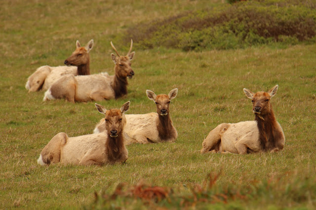
Tule Elk viewing, up to 10 mile out and back hike at the northern tip of Point Reyes. You will always find Elk here and usually from close viewing.
When? :
Year round
Due
note 1: The hike here is exposed to wind and rain so try to come in good weather
conditions.
Due
note 2: I recommend to visit this section of the park early in the morning. There are fewer other visitors, at nice weekend midday it can be crowded, and during the morning the Elk are more active.
Due
note 3: Pets are prohibited in this park section.


Due note 4:
Few Elk safety guidelines:
·
Observe elk from a distance. If an
elk becomes alert or nervous and begins to move away, you are too close.
·
If you are on foot, stay on the
trail; do not come between a cow and calf, a bull and a group of cows, or two
bulls challenging each other.
·
Do not feed the elk.
·
If viewing from your car, pull off
the road or park in designated areas.
My thoughts:
Highly recommended place to visit.
I visit here many times and always
manage to see Elks herds and impressive males’ group.
The
visit:
After driving
17 miles from hwy 1 and taking the Pierce Point road to the north you will arrive
to the end of the road at Pierce Point Ranch and parking lot.
This is an old & well preserved Pierce Point Ranch from the glory cattle days of Point Reyes during 1800’s.

After short visit at the ranch the main interest in this park section
is the Tule elk viewing.
By 1860 all the native elk population was no longer exist in this aria.
In the spring of 1978, two bulls and eight cows were brought in, that summer, six of the cows bore calves. Year after the elk were released to the 2,600 acres reservation at the tip of Point Reyes.
In 2009, over 440 elk were counted at Tomales Point, making the Point Reyes herds one of the largest populations in California.


Usually
you can spot a large Tule elk herds at the fields near the entrance to the preserved section and if not,
they can be viewed from the hiking trail that start at the farm houses parking lot.

The
hike itself is not difficult and the trail is well-maintained, kids can do it but it is not
good for strollers.
Start the trail at the ranch heading to Tomales Point, if you are going all the way to the north tip this will be 5 miles hike in each direction.
For elks viewing,
you do not need to hike the entire trail.
Usually the elk herds can be spotted not so far from the trail after a mile.
The elks are used to
hikers so they are not running away or hiding, some time they can walk few
meters away from the trail.


Usually the males are not hanging together with the females & cabs herd.
Do not miss the opportunity to see them; Keep on walking until you will spot the mail groups.
You will probably see male groups after passing the high ridge section where
the trail starts to descend and there is a small pound on your right.
Usually
you can see the male group after 2-3 miles walk, ask people coming back were
they spotted the male group.
Once you
are done with the elk viewing you should go back to the ranch on the same trail
you hike in.


You can hike all the way to the end of the 5 miles trail that will take you to the north tip of the land.
The last 1 mile of the trail is less maintained but still visible.
Once reaching the land-end you will see the vast ocean view to
the north, there is not much more to see or to do over here.


McClures
Beach:
McClures Beach is another place you can visit at Pierce Point Ranch.
They fix the road
The
road to the beach parking is close so you start the hike at the main parking
lot near the ranch.
Go down to the beach in a short ½ mile trail.
It is a nice sandy beach with rocky cliff on all sides.
You can explore the south section of the beach, cross the big rock formation into a small cove with many sea stars and other interesting thing to explore.
Recommended timing is during low-tide and low wave conditions.
You can’t go
there when it is stormy or during high tide that may block the access.


Comments
Post a Comment