Introduction:
What? :
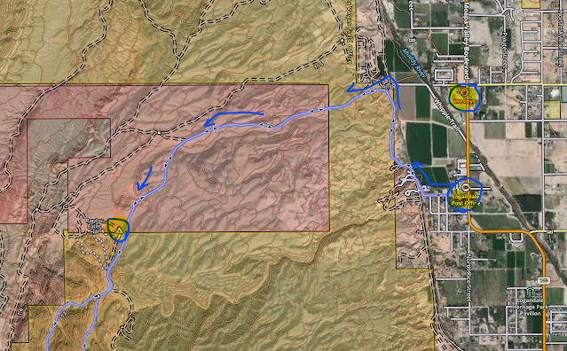
Logandale BLM
OVH area is spread over 45,000 acres and 200 miles offroad trails system leading
you in between the red rock hills and boulders to unique desert sceneries as well
as playground of a large section red sand dunes that are the signature of this
off-road heaven.
The trails can
accommodate a variety of skill levels, most are mid-level.
We did a 15 miles
offroad loop drive (although the loop name is “13 miles”).
The main loop drive
is mildly challenging with some deep sand dune area, for most stay in 4-high
unless you are taking this loop at a slow speed or overcoming side rocks/climb challenge.
I recommend driving
it counterclockwise so you will save the long send dune to be last, but you can
go in any direction.
It will take
you about 2-3 hours to complete.
Where? :
Moapa Valley is
about 62 miles north of Las Vegas, or 73 miles south of St. George, Utah.
From I-15, take
Nevada Hwy 169 toward Logandale/ Overton.
Turn right on
Liston Rd. Follow the road to the right, cross the railroad track. The dirt
road turn left away from the track, follow the road into the LTS area.
From the rail
crossing this will be 3 miles driving on well-maintained road until you will reach
staging area.
Google Map Link
When? :
The BLM area is
open year-round but the best time to visit here is Oct - April.
Summer months
introducing scorching hot with mid-day temperatures rising to 115f.
Summer
afternoons may have monsoon rain, there are flash flood possibility so be aware,
but the wet dunes will get easier to ride on.
Winter have low
night and early morning temperatures but perfect day temperatures with almost
no rain at all.
Due note 1:
This is OVH (Off-Highway
Vehicle) area so Dune buggies/side by sides and any other off-road vehicle are welcome.
Due note 2:
The desert is a
fragile ecosystem, and it doesn’t take much to damage the landscape for many
years forward, trails leading to a top of a hill will stay there for many years.
There are many well-marked trails and sand dunes in this system. You won’t need
to drive past the existing trails and designated routes, respect the lad.
Due note 3:
Cell reception in
the area might be limited, downloading a trail map of the area in advance.
Due note 4:
Restrooms and
few picnic table with shade are available in the staging area.
Due note 5:
Located in
Moapa Valley, you can find here plenty of food and grocery stores.
The nearest gas
station is on highway 169, Logandale, 0.7 mile north of W Liston Ave.
There is
another gas station south of here.
There are gas
stations on highway I-15, at Moapa.
Due note 6:
Primitive
Camping is available at designated campsites where there are fire rings.
Due note 7:
Make sure that
your off-road vehicle is up to the trip, that you have a basic recovery kit and
the knowledge how to use it.
Due note 8:
Although not so
much remote and very popular destination, especially during weekends, traveling
in groups is always a good idea.
My thoughts:
This is fun
place to spend few hours off-road drive that combine interesting red rock
landscape, vast area and fun send dune drive.
- Valley of Fire State Park
- Red Rock Canyon Nevada
- Red Rock Canyon – Calico Tanks Trail
- Red Rock Canyon – Turtlehead Mountain Hike
- Red Rock Canyon – Calico Basin Trail
- Red Rock Canyon – Guardian Angel Gully Passage
- Red Rock Canyon – Calico Hills Loop Hike
- Lake Mead NRA – Goldstrike Hot Springs
- Lake Mead NRA – Hoover Dam South Viewpoint, Off Trail Hike
- Arizona Hot Springs Hike
- Lake Mead National Recreation Area – Visiting Hover Dam
- Lake Mead NRA – Boulder City, NV; Old Train Track Hike
- Lake Mead NRA – Sunset View Scenic Overlook
- Lake Mead NRA – Owl Canyon Hike
- Lake Mead National Recreation Area – Northshore Road
- Lake Mead NRA – Anniversary Borax Mine and Canyon Hike
- Lake Mead NRA – Redstone Area Hike
- Lake Mead NRA – Rogers Spring


Comments
Post a Comment